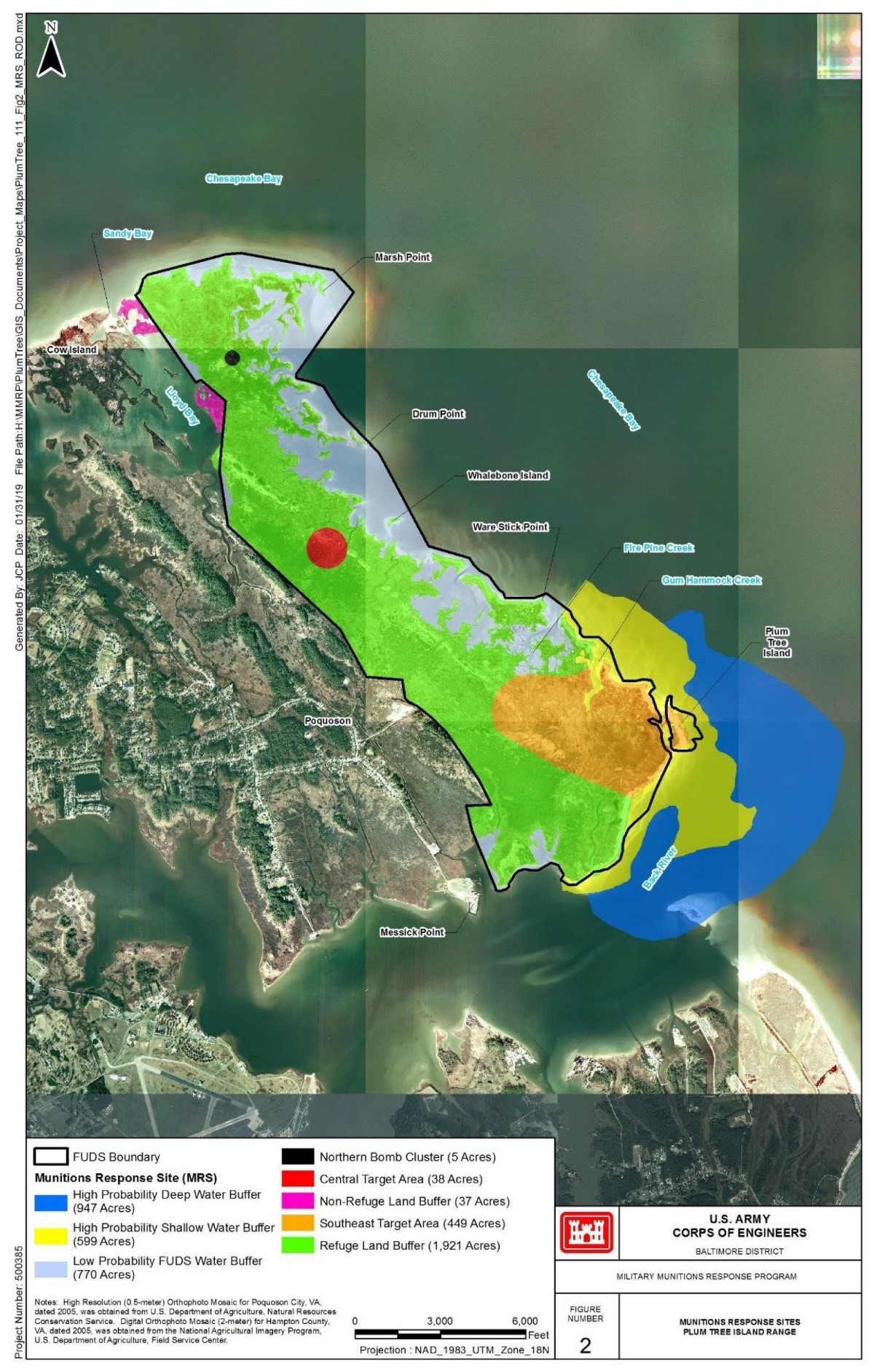
Plum Tree Island National Wildlife Refuge in Poquoson, VA, was formerly known as the Plum Tree Island Range and used for aerial bombing and gunnery practice from 1917 through the late 1950s. The former bombing range consisting of approximately 3,000 acres was transferred to the U.S. Fish and Wildlife Service (USFWS) in 1972.
The entire refuge remains closed to all public use due to the potential for encountering unexploded ordnance (UXO). Known extensive usage of the southern portion of the Refuge for bombing and the presence of UXO along the shoreline prompted the U.S. Army Corps of Engineers (USACE) to establish a Danger Zone in the shallow water along the southern half of the Refuge. This Danger Zone is marked by warning signs, and disturbance of the channel bottom is prohibited.
A revised Feasibility Study (FS), FS Addendum and Proposed Plan (PP) were completed and approved in 2018. The PP outlined the various remedy approaches for the various former ranges at the site. The public comment period for the PP was completed in August 2018. Public meetings were held in July 2018.